| TMS: 095-00-00-048 Owner Information:
Owner Occupied Property: No Homestead Exempt (Age 65+ or Disability): No | Council District: C7 Fire District: F27 Tax District: T07 TIS Zone: 5 Jurisdiction: 1P Acres: 1.88 Lots: 0.0 |
Neighborhood: D120 - CROSS (WEST) Appraiser ID: RS Lot: Block: Section: Zoning: Berkeley County - Flex1 Parent TMS: Notes:1-91 COMBINED MOBILE HOME AND LAND FOR HS REASS OK 9-98 9/01 U/CB MH#13960 & LAND PER AUDITOR ETAL: ALVILDA GROOMS-CALVIN MOORE JR-BARBARA WIGGI NS-ERVIN MOORE SR-PEARL WISCAVER 10/2001 NO CHANGE REASSESSMENT 2004 7/02 |
| Site addresses: | ||||||||||||||||||||||||||||||||||||||||||||||||||||||||||||||||||||||||||||||||||||||||||||||||||||||||||||||||||||||||||||||||||||||||||||||||||||||||||||||||||||||||||||||
|---|---|---|---|---|---|---|---|---|---|---|---|---|---|---|---|---|---|---|---|---|---|---|---|---|---|---|---|---|---|---|---|---|---|---|---|---|---|---|---|---|---|---|---|---|---|---|---|---|---|---|---|---|---|---|---|---|---|---|---|---|---|---|---|---|---|---|---|---|---|---|---|---|---|---|---|---|---|---|---|---|---|---|---|---|---|---|---|---|---|---|---|---|---|---|---|---|---|---|---|---|---|---|---|---|---|---|---|---|---|---|---|---|---|---|---|---|---|---|---|---|---|---|---|---|---|---|---|---|---|---|---|---|---|---|---|---|---|---|---|---|---|---|---|---|---|---|---|---|---|---|---|---|---|---|---|---|---|---|---|---|---|---|---|---|---|---|---|---|---|---|---|---|---|---|
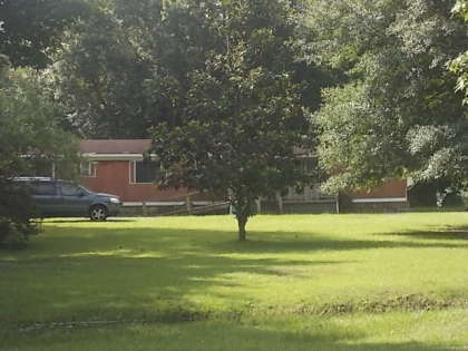
| 1071 OLD WIGGINS RD HOLLY HILL, SC 29059, Unit/Lot: | 1071 OLD WIGGINS RD HOLLY HILL, SC 29059, Unit/Lot: 1 | |||||||||||||||||||||||||||||||||||||||||||||||||||||||||||||||||||||||||||||||||||||||||||||||||||||||||||||||||||||||||||||||||||||||||||||||||||||||||||||||||||||||||||||
| Owner: BERKELEY COUNTY DELINQUENT TAX COLLECTOR | Sale Date: 03/14/2024 | Sale Price: $30,000.00 | Deed Book-Page: 4809 - 693 | Plat: BK W - 129 | Transfer Notes: |
| Owner: MOORE CALVIN A ESTATE O | Sale Date: 10/24/2001 | Sale Price: $0.00 | Deed Book-Page: 2458 - 0294 | Plat: W - 129 | Transfer Notes: 1.88 |
| Owner: MOORE MAYBELL DEED OF D | Sale Date: 02/23/2001 | Sale Price: $0.00 | Deed Book-Page: 2248 - 0056 | Plat: W - 129 | Transfer Notes: 1.88 |
| Owner: GROOMS SAMUEL AND PATTY | Sale Date: 01/30/1989 | Sale Price: $2,000.00 | Deed Book-Page: A793 - 0234 | Plat: W - 129 | Transfer Notes: 1.88 AC Acres Recorded on Plat W - 129 |
| Owner: WIGGINS W H | Sale Date: 10/29/1976 | Sale Price: $900.00 | Deed Book-Page: A319 - 0140 | Plat: W - 129 | Transfer Notes: 1.88 AC Acres Recorded on Plat W - 129 |
| Tax Year | Receipt # | Tax District | Original Total | Total With Penalties (if applicable) | Pay Date | Pay Type | Delinquent | Taxed Value | Owner Occupied (4% QR Rate) |
|---|---|---|---|---|---|---|---|---|---|
| 2023 | 0900047 | 7 | $355.56 | $355.56 | 03/27/2024 | Paid | Yes | $24,300 | No |
| 2022 | 0074434 | 7 | $376.13 | $376.13 | 03/26/2024 | Paid | Yes | $24,300 | No |
| 2021 | 0071573 | 7 | $379.21 | $581.09 | 10/24/2022 | Landsale | Yes | $24,300 | No |
| 2020 | 0074182 | 7 | $380.79 | $442.91 | 05/06/2021 | Paid | Yes | $24,300 | No |
| 2019 | 0072633 | 7 | $379.92 | $417.91 | 02/05/2020 | Paid | No | $24,300 | No |
| 2018 | 0071294 | 7 | $350.41 | $385.45 | 03/01/2019 | Paid | No | $21,200 | No |
| 2017 | 0069756 | 7 | $89.15 | $107.52 | 04/03/2018 | Paid | Yes | $21,200 | Yes |
| 2016 | 0067919 | 7 | $91.76 | $100.94 | 02/02/2017 | Paid | No | $21,200 | Yes |
| 2015 | 0067814 | 7 | $83.06 | $83.06 | 01/07/2016 | Paid | No | $21,200 | Yes |
| 2014 | 0066422 | 7 | $82.02 | $82.02 | 12/11/2014 | Paid | No | $21,200 | Yes |
| Last Sale Date: 03/14/2024 Recording Date: 03/20/2024 Sale Price: $30000.00 | Plat Information: BK W - 129 Deed Book: 4809 Deed Page: 693 | Sales Validity: 9A Validity Other: 9E |
| Building Market: 0 Land Market: 56,400 | Building Taxable (4% Res): 0 Building Taxable (6% Other): 0 Building Taxable (4% Ag): 0 Building Taxable (6% Ag): 0 | Land Taxable (4% Res): 0 Land Taxable (6% Other): 24,334 Land Taxable (4% Ag): 0 Land Taxable (6% Ag): 0 |
| Total Taxable Value: 24,334 Total Assessment: 1,460 | ||
| Building Count: 0 Residence Count: 0 | Yard Item Count: 0 Mobile Homes on Property: 2 |
| Decal # | Owner Name | Street Address | Storage? | Year Built | Dimensions |
|---|---|---|---|---|---|
| 23269C | MOORE CALVIN A JR | 1071 OLD WIGGINS RD 001 | N | 1987 | 44x24 |
| 13960C | WISCAVER PEARL E | 1071 OLD WIGGINS ROAD | N | 1973 | 65x12 |