
Penny A. Ayers
CFM
Floodplain Specialist
T: 843-719-4266
vog.csytnuocyelekreb@sreya.ynnep 1003 US Highway 52 Moncks Corner, SC 29461
Starting October 1, Risk Rating 2.0 will fundamentally change the way FEMA rates a property’s flood risk and prices insurance for the more than five million National Flood Insurance Program (NFIP) policyholders.
The new methodology incorporates more flood risk data variables to more accurately reflect a property’s individual flood risk, including the frequency and types of flooding, such as river overflow, storm surge, coastal erosion, and heavy rainfall — and the distance to a water source along with property characteristics, such as elevation and the cost to rebuild. Including a property’s replacement cost value in the new methodology was a major component in the delivery of equitable rates.
ASFPM developed the maps as a more user-friendly format for floodplain management professionals, practitioners, and local leaders to gain greater insight into the new rating system so they can better understand and communicate what’s occurring in their communities. ASFPM used datasets from FEMA’s NFIP policyholder information to create the easy-to-use data visualization tool. The data are broken down across four categories — ranging from a decrease in premiums to an increase of $20/month or more. A color-coded scale indicates the percentage of policyholders in each category.
The state-level interactive map at no.floods.org/rr2changes breaks down projected premium changes for each state and territory. The interactive map also includes corresponding pie charts and data tables that provide policy and percentage change breakdowns.
For those who wish to take a deeper dive, there is also an interactive map by zip code for existing single-family home policies at no.floods.org/rr2sfh and for all existing NFIP policies at no.floods.org/rr2all.
The data compares a snapshot of policyholder premiums from May 31, 2020 with Risk Rating 2.0 premiums, applying statutory increase limits. The comparison does not attempt to estimate premium increases that might have occurred without the new Risk Rating 2.0 pricing methodology.
“These interactive maps will help local leaders and government officials understand how the new and more equitable flood insurance rates will be distributed,” said Laura Lightbody, director of The Pew Charitable Trusts’ flood-prepared communities initiative, which provided support for development of the maps. “In many cases, people have been overpaying for flood insurance; these maps show us that almost 1.2 million policyholders will see decreases very soon.”
This is the program’s first pricing update in more than 40 years.
“Under Risk Rating 2.0, FEMA is fixing longstanding inequities in the NFIP’s flood insurance pricing and establishing a system that is better equipped for the reality of frequent flooding caused by climate change,” said David Maurstad, senior executive of the National Flood Insurance Program. “Risk Rating 2.0 is not just a minor improvement, but a transformational leap forward that enables FEMA to set rates that are fairer and ensures rate increases and decreases are both equitable.”
According to FEMA, only 4% of policyholders nationwide are expected to see substantive increases. In a national rate analysis of current policyholders, FEMA has said 23% will see premium decreases; 66% will see, on average, premium increases of $0-$10/month (which is around what the average is now); 7% will see, on average, premium increases of $10-$20/month; and 4% will see, on average, premium increases of $20 or more per month.
Individual policyholders should contact their insurance agent for a personalized quote.
Background on Risk Rating 2.0
Risk Rating 2.0 will deliver rates that are actuarially sound, equitable, easier to understand, and better reflect an individual property’s unique flood risk. By communicating flood risk more clearly, the new methodology should help policyholders make more informed decisions on the purchase of adequate insurance and on mitigation actions to protect against flooding.
FEMA is implementing the program in two phases:
- Phase I – New policies beginning Oct. 1, 2021 are subject to the new pricing methodology. Also beginning October 1, existing policyholders are able to take advantage of immediate decreases in their premiums when the policy renews.
- Phase II – Renewals of the remaining existing flood insurance policies will be written to the new plan starting April 1, 2022, allowing policyholders an additional six months to prepare for any adjustments.
Who is the Floodplain manager and how do I contact them?
The Floodplain Manager for Berkeley County is Penny Ayers. She can be reached by phone at 843-719-4266, by email at vog.csytnuocyelekreb@sreya.ynnep or by departmental email, marked to her attention, at vog.csytnuocyelekreb@edcbew.
Do I have to carry Flood Insurance?
Yes. Flood insurance is mandatory for the life of a mortgage. If the home is in a special flood hazard area then an elevation certificate with pictures is required for proper rating. If the home is not in the flood zone or the homeowner disagrees they may apply for a Letter of Map Amendment (LOMA). This would remove the structure only from the flood zone and then lower the insurance rating. This application information can be obtained at the Berkeley County Office Building in the Building & Codes Department.
Are there specific construction requirements in the SFHA (special flood hazard area)?
Yes. The construction information is different for the SFHA than in areas not in the flood areas. There are elevations required, venting and special stages of inspection. This information can also be obtained at the County Offices in the Building & Codes Department.
Is there anything to help me understand Floodplain Management and how I am affected?
FEMA publications can be picked up at the Berkeley County Government office in the building and codes department. These publications are free to the public. There are also publications in the Berkeley County Libraries in Moncks Corner and Goose Creek.
What is a Special Flood Hazard Area (SHFA)?
In support of the NFIP, FEMA identifies flood hazard areas throughout the U. S. and its territories by producing Flood Hazard Boundary Maps (FBMs), Flood Insurance Rate Maps (FIRMs). Several areas of flood hazards are commonly identified on these maps. One of these areas is the Special Flood Hazard Area (SFHA), a high-risk area defined as any land that would be inundated by a flood having a 1-percent chance of occurring in any given year (also referred to as the base flood).
The high-risk-area standard constitutes a reasonable compromise between the need for building restrictions to minimize potential loss of life and property and the economic benefits to be derived from floodplain development. Development may take place within the SFHA, provided that development complies with local floodplain management ordinances, which must meet the minimum Federal requirements. Flood insurance is required for insurable structures within high-risk areas to protect Federal financial investments and assistance used for acquisition and/or construction purposes within communities’ participation in the NFIP.
Why is my lender requiring the purchase of flood insurance?
For virtually every mortgage transaction involving a structure in United States, the lender reviews the current NFIP maps for the community in which the property is located to determine its location relative to the published SFHA and completes the Standard Flood Hazard Determination Form (SFHDF). If the lender determines that the structure is indeed located within the SFHA and the community is participating in the NFIP, the borrower is then notified that flood insurance will be required as a condition of receiving the loan. A similar review and notification is completed whenever a loan is sold on the secondary loan market or perhaps when the lender completes a routine review of its mortgage portfolio. This fulfills the lender’s obligation under the Flood Disaster Protection Act of 1973 and the National Flood Insurance Reform Act of 1994 that requires the mandatory purchase of flood insurance by property owners who are being assisted by Federal programs or by Federally regulated institutions in the acquisition or improvement of land, or facilities, or structures located to be located within an SFHA.
Is there a waiting period for flood insurance to become effective?
There is normally a 30-day waiting period before flood insurance goes into effect. There are two basic exceptions:
- If the initial purchase of flood insurance is in connection with the making, increasing, extending, or renewing of a loan, there is no waiting period. The coverage becomes effective at the time of the loan, provided the application and presentment of premium are made at or prior to loan closing.
- If the initial purchase of flood insurance is made during the 13-month period following the revision or update of a Flood Insurance Rate Map for the community, there is a 1-day waiting period.
- In addition to the two basic exceptions, FEMA has issued a policy decision specifying the following four exceptions: The 30-day waiting period will not apply when there is an existing insurance policy and an additional amount of flood insurance is required in connection with the making, increasing, extending, or renewing of a loan, such as a second mortgage, home equity loan, or refinancing. The increased amount of flood coverage will be effective as of the time of the loan closing, provided the increased amount of coverage is applied for and presentment of additional premium is made at or prior to the loan closing.
- The 30-day waiting period will not apply when an additional amount if insurance is required as a result of a map revision. The increased amount of coverage will be effective at 12:01 a. m. on the first calendar day after the date the increased amount of coverage is applied for and presentment of additional premium is made.
- The 30-day waiting period will not apply when flood insurance is required as a result of a lender’s determining a loan that does not have flood insurance coverage should be protected by flood insurance. The coverage will be effective upon the completion of an application and the presentment of payment of premium.
- The 30-day waiting period will not apply when an additional amount of insurance offered in the renewal bill is being obtained in connection with the renewal of a policy.
How can I check the availability of elevation certificates?
The general public, lenders, and insurance agents of the availability of elevation certificates can request copies from the Floodplain Manager for Berkeley County Monday-Friday, 8:00am to 4:00pm. To obtain a copy of the elevation certificates by emailing the Floodplain Manager or by faxing requests to 843-719-4053.
Can I get flood insurance if I’m not mapped in a flood zone?
Because Berkeley County participates in the National Flood Insurance Program (NFIP), most properties in the county are eligible to purchase federally subsidized flood insurance. Standard home insurance policies do not cover flood damage, therefore, if you do not have a mandatory flood policy it’s important to determine if your home is at risk. It’s also important to know there is typically a 30-day waiting period from date of purchase until your policy becomes effective. Flood policies can secure coverage for residential properties up to $250,000 for buildings and up to $100,000 for building contents, which can be purchased together or independently. Commercial property is similar with coverage limits at $500,000 for the building and $500,000 for contents. Rating information and further discussion can be found at www.floodsmart.gov
What are my Flood Hazards?
It is important for residents to familiarize themselves with surrounding flood hazards such as swamps, streams, rivers, lakes, or low areas that hold stormwater. You can use the County GIS Mapping System to research properties by address, tax map number, or owner name, and use mapping layers including FEMA Flood Data, National Wetlands Inventory, Berkeley County Hurricane Surge and Water Layers to gain knowledge of potential flood hazards (gis.berkeleycountysc.gov). The County website also allows you to search for available Elevation Certificates that may give you more information about a homes potential flood threat. (https://berkeleycountysc.gov/propcards/floodcert_search.php).
What is the process for building within the FEMA Floodplain?
If your property is located within a FEMA designated flood area, please contact the County Permitting Dept or Floodplain Management before starting any construction projects on your parcel. This will ensure the County reviews all necessary documents that may be needed, such as an Elevation Certificate, and discuss what flood mitigation strategies should be used before issuing necessary permits. It’s more costly to fix building construction mistakes post-construction rather than properly plan.
Why Is It Important to Protect and Maintain Floodplains?
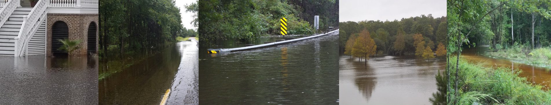
Floodplains are low-lying areas that are susceptible to inundation by floodwaters from any source. Undeveloped floodplains provide many natural resources and functions of considerable economic, social, and environmental value. They include wetlands, fertile soils, rare and endangered plants and animals, and sites of archaeological and historical significance. Two of many issues that result from floodplain development are: development alters the floodplain and the dynamics of flooding, and buildings and infrastructure are damaged by periodic flooding. It’s important to protect our floodplains by promoting green infrastructure, restoring floodplain habitats, and alleviate littering and/or dumping in floodplains.
How can I prepare my home for flooding?
If you know your home is in an area that floods and/or in a FEMA designated flood zone, make sure that items subject to water damage such as furnaces, HVAC, and electrical equipment are above the flood level. You should also store important documents in a high, waterproof container. If your home has a crawlspace, check that you have venting on at least two sides of the foundation walls and that the vents are permanently open. Make sure you clear any debris from gutters and downspouts to avoid an accumulation of water. If you have a flood insurance policy, spring is a good time to review the terms and limits. You can find more helpful information about flood preparation at ready.gov/floods.